Tignes is perfectly set up for mountain biking in summer with a handful of lift accessed zones and plenty of cross country and enduro riding.
Find loads of top tips and local insights in our Tignes Mountain Biking Guide.
Discover the top Tignes biking routes
Tignes is perfectly set up for mountain biking in summer with a handful of lift accessed zones and plenty of cross country and enduro riding.
Find loads of top tips and local insights in our Tignes Mountain Biking Guide.

Beginner or family friendly trails for those just starting out and practise areas
There are a handful of easy trails for beginner mountain bikers or those looking to learn a few skills before venturing onto some of the harder trails.
A flow beginners trail with nice wide switchbacks to practise your technique on. Distance: 5.5km and descends 460m. Start: Top of Palafour and ends in the same place.
Green and Blue and a perfect introductory trail for beginners and arguably the easiest green trail in resort. It's got lots of curvy, wide berms. Distance: 4.5km. Descends -460m. Start: Top of Palafour Lift and ends in the same place.
There's only one green trail in Val d'Isère and it's a whopping 12km long. Start at the top of the Olympique lift and descend -850m back down towards La Daille village.

Easier trails for beginners and progressing mountain bikers on both sides of the valley
A number of blue trails are dotted about the Tignes bike park, on both sides of the valley, some of which link to the neighbouring Val d'Isère area.
Involves a bit of pedalling but it's worth the effort. It's a nice long trail taking you across to Val Claret.
Distance 2km and descends -300m. Start: Top of Palafour. Finish: Val Claret at the bottom of the Tichot lift.
Fast and flowy with lots of little jumps as the name suggests. It's a popular trail because it's so much fun and a good place to practise going a bit faster rounds berms.
Distance: 3.4km and descends -460m. Start: Top of Palafour. Finish: Bottom of Palafour.
Heaps of jumps (hence the name) and berms plus two long tables. Follows natural features, stony in places. Distance: 1.3km and descends -595m. Start: Top of Aeroski. Finish: Val Claret.
A good long singletrack trail that links up with lots of other blues. The odd hip jump, and 12 berms. The surface can get a bit loose.
Distance: 4.5km and descends -500m. Start: Top of Aeroski. Finish: Val Claret.
A 3km long trail starting from about half way along the Borsat lift and descends -500m, joining with Gunpowder trail to take you back to Val Claret.
Start on Sweet Sweet and take the first right junction you come across. You'll see a left turn onto an Elite track (don't take this unless you can really ride and jump big!). Descend -500m where you'll join Kangooride back to resort.
One of the trails that links the two areas of the bike parks in Val and Tignes together. Starts at the top of the Toviere lift and meets Val Bleue trail towards the bottom of the Borsat lift. 2.7km long and descends -300m.
A 3.5km blue trail taking in the ridge line. Starts at the top of the Borsat lift and descends -400m back to the bottom of the lift.
A long loop of a trail at 6.5km long from the top of the Bellevarde lift, down the valley towards the lake and joins the green trail Popeye to being you back towards la Daille village. -680m descent.

There are a real mixture of enduro rides to be had in the area graded from easy to difficult
You'll find a great selection of routes here, from picturesque valley and wooded rides to more exposed ridge lines and descents to the valley floor.
Trails are graded from the easier 'Improver' to 'Advanced' and 'Expert' depending on the technical nature of the trails or how much climbing uphill is involved.
Two trails can be found on the Palafour side of Tignes bike park - Cow Lanta and Trailspotting.
Starts not far from the bottom of the Palafour lift and turns into a loop with views of the lake and back again. 6km, +350m, -350m.
An 8km loop around the top of the Palafour lift and passes the Lacs du Chardonnet. +350m, -350m.
Starts in the centre of Tignes and takes you all the way down to Les Brévières (great at the end of the day if you're camping down there). It has amazing views over the dam and the lake. 4km long, +75m, -530m.
On the Val d'Isère side is a short link coming off the Borsat Attak DH trail covering just 1.5km and -160m with no uphill.
A 2.5km long trail starting from part way down Smoothie green DH track. It traverses the mountain and joins up with Rocky Trail at the end (below). +75m, -300m.
A 7km long trail starting from the top of the Palafour lift, heading over in the direction of Brévières. It joins with Wonderboisses trail at the bottom overlooking the dam. +150m, -880m.
A ridge line trail running from the top of the Toviére lift across towards Borsat. It's 10km long, +150m, -730m and joins up with Sweet Sweet blue DH track at the end or Val Bleue if you want to head back into Val d'Isère.
On the Val d'Isère side, it starts from part way down Val Bleue DH trail and then traverses right into the head of the Manchet Valley. The descent into the valley is pretty spectacular and the trail ends at the bottom of the Olympique lift. Surprisingly for a trail of 8km long there is no climbing, just -840m of sweet descent.
At 10km long this route has the most amount of climbing you'll find on one of the enduro trails +500m. Start in Tignes 1800 and descends past the dam wall into Les Brévières -790m.
As the name suggests it's a tree-lined trail starting in 1800 and dropping into Brévières from the opposite side to Conduite Forcée. 5.5km, +60m, -780m.
Starts part way down Rocky Trail (see above) and joins with Forest Bump. 5.5km long, +60m, -780m.
Starts from the blue DH trail Borsattack from the top of the Toviéres lift. It takes you round the back of the face with all the gnarly black DH tracks on and back into Le Lavachet. 5km long +100m - 895m.
6.5km long and starts from the top of the Olympique lift heading down the ridge and into the valley above La Daille. +150m -610m.
Starts from the top of the Borsat lift where you first join the Val Bleue DH trail and then take the 2nd right on the VBT trail. It follows the col all the way down to the bottom of the Olympique lift. 7.5km, +100m, -1,050m (the longest descent in the bike park).
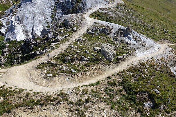
More technically challenging riding for intermediate riders in the bike park and further afield
Step up your game on some more technically challenging red trails in Tignes bike park. There are some over in Val d'Isère to look out for too, which you can connect to easily via the lifts.
Access from the Aeroski / Tovière Lift:
Access from the Palafour Lift:
Val d'Isère Side:

Not for the faint hearted, these are technically difficult trails for experts
The black mountain bike trails in Tignes bike park are split into two categories - Expert and Elite, and they're only to be ridden by the most competent of bikers, with the skills to handle them.
The longest of the black trails at 3km long with a drop of 340m. It's got some huge kickers and gap jumps, massive banked corners and a steep death drop into two jumps on one section. Definitely one for only the most advanced riders who can handle big air. Start at the top of Tovière and finish on Gypsy red trail then back into the centre of resort.
Very steep, very loose full-on descent - strictly for expert level riders. Distance 1km and descends 250m. Start from top of Aeroski and finish at Rosset.
A very tough black trail, with steep narrow and very technical sections which links onto Black Metal. 1km and descends 250m. Start at the top of Aeroski and finish at the top of Black Metal.
The only Elite graded track in resort, and as the name suggests it's hard as nails. Start from part way down the Taretaise Airline blue trail and finish above Val Claret, rejoining the red or blue trails back to the village. Expect huge gap jumps and really technical riding.

Take your pick of over 150km of trails, you'll find something for every level of rider
From June to September each year Tignes opens up its biking trails, from green beginners trails up to black (expert) and double black (elite) tracks.
There are a number of trails, which are all graded and well signposted, plus enduro trails and cross-country trails.
Access to a couple of green and blue trails and a few XC routes. This side of the valley is more grassy meadows with more gently rolling descents and a few sections of north shore and the odd wall ride.
Gets you up to the top of the Tovière peak where you'll find more loose shale, and rockier, steeper descents on red and black trails. Over the back of the Tovière area, a couple of really long blue runs (Gunpowder and Funky Tufs) which bring you back down to Val Claret, and an enduro loop called Ice Tignes.
You can also link up to neighbouring Val d'Isère to make even more of the vast number of trails on offer (over 150km of them), and the great thing is it's all FREE.
Look out for the blue trail called Sweet Sweet going from Val d'Isère to Tignes, or the Borsat Attack trail from the top of the Aeroski if going from Tignes to Val d'Isère.
Take a look at the different grade of trails available in both areas of the bike park in the sections below.