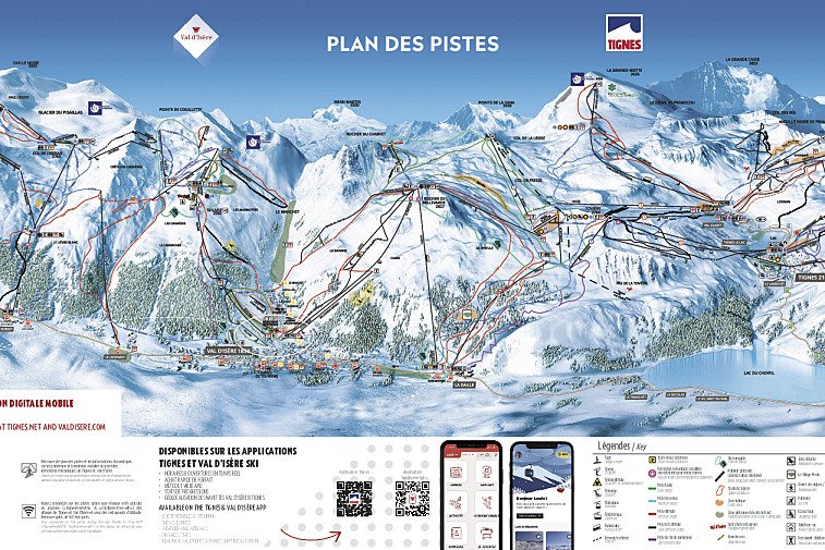
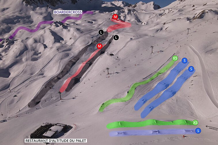
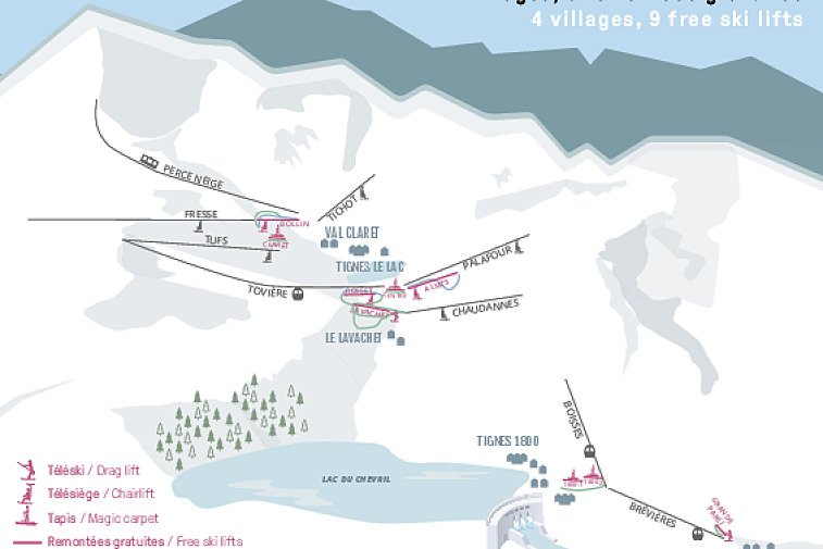
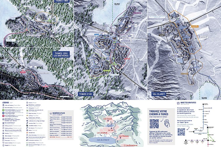
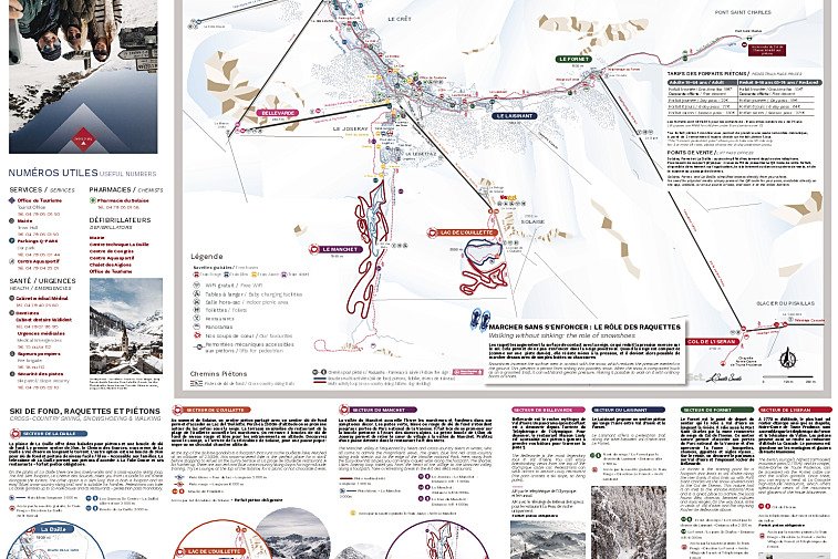
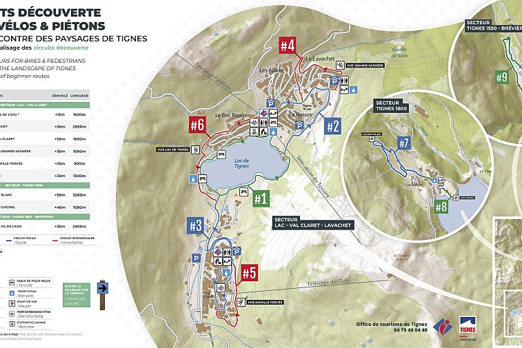
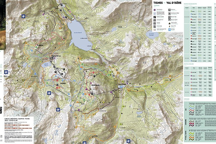
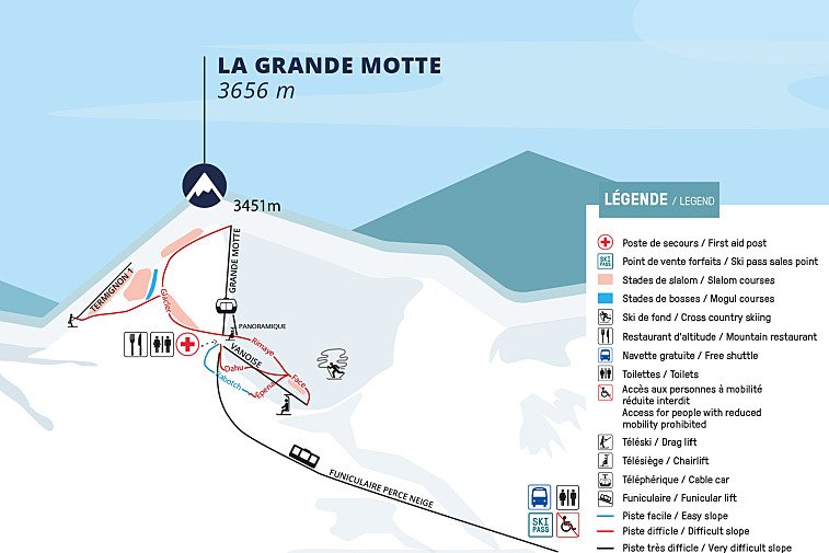
We hope this selection of piste and lift maps, street maps, and activity area maps for Tignes will help you find your way around so you can make the most of this great part of the world.
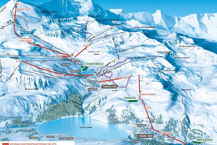
Tignes is made up of a number of small resorts at various altitudes - Tignes Les Boisses, Tignes Le Lac, Tignes Le Lavachet, Tignes Les Brevieres and Tignes Val Claret. Each village has its own local pistes and are connected to each other by the lift network and the public bus system.


![a picture of a hotel suite at [itemref]](https://cdm0lfbn.cloudimg.io/v7/_images_base_/image_uploader/photos_e2/original/campanules-174-suite.jpg?ua=1766578616&p=listing_summary_middle)